Phang Nga Geography
 Phang Nga is on the southwest coast of Thailand on the Malay Peninsula. The province's capital town is 788km drive south of Bangkok. It is 930km north of the equator (8.2 degrees latitude). This puts it on a parallel with countries such as Ethiopia, Somalia and Venezuela.
Phang Nga lies by the Andaman Sea which is part of the Indian Ocean. The province is 4,171 sq km. which includes islands to the west and southeast of the province. The province mainland is 135km long at its longest point and 52km wide at the widest point. The east of the province is high mountainous terrain that slopes down towards the western coastline.
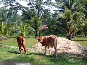
The province's topography is mostly jungle covered mountains which cover more than 55% of the land. The highlands are granite rock. The west and southwest of the province have some low plains which are suitable for agriculture although the soils can be rather sandy. These areas have rubber plantations, palm oil, coconut groves and other agriculture.
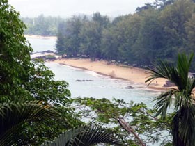
 The province's 240-kilometer winding coastline is almost entirely sandy beaches or coastal mangroves. The best beaches are all along the western coastline where the rainy season waves pound into the coast forming beautiful sandy beaches.
Phang Nga province includes 105 islands. These include the spectacular Similan and Surin islands to the west which are world renowned scuba diving and snorkelling locations.
To the southeast of the province is Phang Nga Bay. This large bay is sheltered from the monsoon winds from the west and the sea is generally calm all year round. The area features the spectacular limestone karst scenery that was made famous in the James Bond movie 'The Man with the Golden Gun'. Great limestone islands rise vertically from the sea and tower spectacularly into the sky. The limestone platform that produces these islands runs east of Phuket from Phang Nga province, through Krabi province and into Trang province producing spectacular scenery all along this stretch of coastline.
Phang Nga also includes the Koh Yao islands even further south than Phang Nga Bay. These two islands are directly east of Phuket and feature similar granite rock geography.
There are several major rivers that flow from the mountains either into the Andaman Sea or into Phang Nga Bay. These include the Nga River, Sai Buri River, and Yaring River.
Phang Nga borders with Ranong province to the north, Surat Thani to the east, Krabi to the southeast and Phuket to the south. The province is subdivided into 8 districts (amphur). They are Mueang Phang Nga (i.e. Phang Nga town the provincial capital), Kuraburi, Takua Pa, Thai Mueang, Takua Thung, Kapong, Thap Put and Koh Yao Islands.
Phang Nga is basically a stable geographic location that until the 2004 tsunami, was not considered an area that ever suffered from major natural disasters. The rainy season always sees a few big storms but nothing that would be categorised as a typhoon. The rainy season does occasionally cause localised flooding.
There is some minor volcanic activity under Phang Nga but nothing that causes any danger. It does provide a few natural hot water springs and one of the province’s attractions is the chance to relax in the hot volcanic water at one of the spas that pump this water into bathing pools.

